Monday, December 6, 2010

MERRY CHRISTMAS and HAPPY NEW YEAR!!


MERRY CHRISTMAS and HAPPY NEW YEAR!!

Saturday, September 25, 2010

FLOODS. (PART 2)


FLOODS. (PART 2)
Dear Readers,
I was really very shocked when I learned about the floods in Tennessee. It is a beautiful State where I have always wanted to build or to own my final home at the time of retirement. There is not much that I ask the Lord, to give me complete peace of mind in my elderly years, not troubles like I have had throughout young years in my lifetime. To decide where to move to, and where to relocate after my retirement, it is not an easy task for me at all. Let´s see why...
The May 2010 Tennessee floods in the United States were 1000-year floods in Middle Tennessee, West Tennessee, South Central and Western Kentucky and northern Mississippi as the result of torrential rains on May 1 and 2, 2010. Floods from these rains affected the area for several days afterwards, resulting in a number of deaths and widespread property damage.
Two-day rain totals in some areas were greater than 19 inches (49 cm). The Cumberland River crested at 51.86 feet in Nashville, a level not seen since 1937, which was before the U.S. Army Corps of Engineers flood control measures were in the Duck River at Centerville and Hurricane Mills, the Buffalo River at Lobelville, the Harpeth River at Kingston Springs and Bellevue, and the Red River at Port Royal.
In the early morning of May 4, flooding at Nashville Electric Service substation caused power failure to go out in downtown, the center of the city of Nashville. Among the buildings that lost electricity was the 617-foot (188 m) AT & T Building, the tallest building in Tennessee. Power was not expected to be restored until Friday, May 7.
Nashville/Davidson County was declared a Federal Disaster Area on May 4.
As of May 7, 30 counties have declared a major disaster areas by the federal government, with 52 submitted to receive that status. This translates to about 31 % of Tennessee currently being designated a mayor disaster area, with potential of over half the state (roughly 53%) being so declared if all that are currently submitted receive that designation by the federal government.
According to Nashville Mayor Karl Dean, damage estimates in Nashville are at about $1.5 billion not including damage to roads and bridges or public buildings, as well as contents inside buildings and residences.
Almost all schools in the area were closed including Metropolitan Nashville Public Schools, some for a week or more.
We are faithful Christians, and we are praying for the State of Tennessee. Lord have mercy!!
Thank your for visiting my site and reading my posts!!
STARRY.

Monday, September 20, 2010

FLOOD. (PART 1)


FLOOD. (PART 1)
A flood is an overflow of an expanse of water that submerges land. The EU Floods directive defines a flood as a temporary covering by water of land not normally covered by water. In the sense of "flowing water", the word may also be applied to the inflow of the tide. Flooding may result from the volume of water within a body of water, such as a river or lake, which overflows or breaks levees, with the result that some of the water escapes its usual boundaries. While the size of a lake or other body of water will vary with seasonal changes in precipitation and snow melt, it is not a significant flood unless such escapes of water endanger land areas used by man like a village, city or other inhabited area.
Floods can also occur in rivers, when flow exceeds the capacity of the river channel, particularly at bends or meanders. Floods often cause damage to homes and business if they are placed in natural flood plains of rivers. While flood damage can be virtually eliminated by moving away from rivers and other bodies of water, since time out of mind, people have lived and worked by the water to seek sustenance and capitalize on the gains of cheap and easy travel and commerce by being near water. That humans continue to inhabit areas threatened by flood damage is evidence that the perceived value of living near the water exceeds the cost of repeated periodic flooding.
PRINCIPAL TYPES and CAUSES.
Flooding of a creek is due to heavy monsoonal rain and high tide, and flash flooding is caused by a severe thunderstorm.
Riverine. Slow kinds: Runoff from sustained rainfall or rapid snow melt exceeding the capacity of a river´s channel. Causes include heavy rains from monsoons, hurricanes and tropical depressions, foreign winds and warm rain affecting snow pack. Unexpected drainage obstructions such as landslides, ice, or debris can cause slow flooding upstream of the obstruction.
Fast kinds: Include flash floods resulting from convective precipitation (intense thunderstorms) or sudden release from an upstream impoundment created behind a dam, landslide, or glacier.
Estuarine. Commonly caused by a combination of sea tidal surges caused by storm-force winds. A storm surge, from either a tropical cyclone or an extratropical cyclone.
Coastal. Caused by severe sea storms, or a result of another hazard (e.g. tsunami or hurricane). A storm surge, from either a tropical cyclone or an extratropical cyclone, falls within this category.
Catastrophic. Caused by a significant and unexpected event, e.g. dam breakage, or a result of another hazard (e.g. earthquake or volcanic eruption).
Muddy. A muddy flood or mud slide is generated by run off on crop land. A muddy flood is produced by an accumulation of runoff generated on cropland. Sediments are then detached by runoff and carried as suspended matter or bedload. Muddy runoff is more likely detected when it reaches inhabited areas. Muddy floods are therefore a hillslope process, and confusion with mudflows produced by mass movements should be avoided.
Other. Floods can occur if water accumulates across an impermeable surface (e.g. from rainfall) and cannot rapidly dissipate (i.e. gentle orientation or low evaporation). When a series of storms are moving over the same area. Dam-building beavers can flood low-lying urban and rural areas, often causing significant damage.
EFFECTS.
Primary effects. Physical damage. Can damage any type of structure, including bridges, cars, buildings, sewer systems, roadways, and canals.
Casualties. People and livestock die due to drowning. It can also lead to epidemics and waterborne diseases.
Secondary effects. Water supplies. Contamination of water. Clean drinking water becomes scarce. Diseases. Unhygienic conditions. Spread of water-borne diseases. Crops and food supplies. Shortage of food crops can be caused due to loss of entire harvest. However, lowlands near rivers depend upon river silt deposited by floods in order to add nutrients to the local soil.
Trees. Non-tolerant species can die from suffocation.
Economic. Economic hardship, due to: temporary decline in tourism, rebuilding costs, food shortage leading to price increase, etc.
Part 2 will follow...
Thank you for reading!!
Starry.

Sunday, September 19, 2010

TORNADO.


TORNADO.

This article is about the weather phenomenon called Tornadoes.
A tornado is often referred to as a twister. The funnel itself is the thin tube reaching from the cloud to the ground. The lower part of the tornado is surrounded by a translucent dust cloud, kicked up by the tornado´s strong winds at the surface.
A tornado is a violent, dangerous, rotating column of air that is in contact with both the surface of the earth and a cumulonimbus cloud or, in rare cases, the base of a cumulus cloud. Tornadoes come in many shapes and sizes, but are typically in the form of a visible condensation funnel, whose narrow end touches the earth and is often encircled by a cloud of debris and dust. Most tornadoes have wind speeds less than 110 miles per hour (117 km/h), are approximately 250 feet (80 m) across, and travel a few miles (several kilometers) before dissipating. The most extreme can attain wind speeds of more than 300 mph (480 km/h), stretch more than two miles (3 km) across, and stay on the ground for dozens of miles (more than 100 km).
Various types of tornadoes include the landspout, multiple vortex tornado, and waterspout. Waterspouts are characterized by a spiraling funnel-shaped wind current, connecting to a large cumulus or cumulonimbus cloud. They are generally classified as non-supercellular tornadoes that develop over bodies of water. These spiraling columns of air frequently develop in tropical areas close to the equator, and are less common at high latitudes. Other tornado-like phenomena that exist in nature include the gustnado, dust devil, fire whirls, and steam devil.
Tornadoes have been observed on every continent except Antarctica. However, the vast majority of tornadoes in the world occur in the Tornado Alley region of the United States, although they can occur nearly anywhere in North America. They also occasionally occur in south-central and eastern Asia, the Philippines, northern and east-central South America, Southern Africa, northwestern and southeast Europe, western and southeastern Australia, and New Zealand. Tornadoes can be detected before or as they occur through the use of Pulse-Doppler radar by recognizing patterns in velocity and reflectivity data, such as hook echoes, as well as by the efforts of storm spotters.
These are several different scales for rating the strength of tornadoes. The Fujita scale rates tornadoes by damage caused, and has been replaced in some countries by the updated Enhanced Fujita Scale. An FO or EFO tornado, the weakest category, damages trees, but not substantial structures. An F5 or EF5 tornado, the strongest category, rips buildings off their foundations and can deform large skyscrapers. The similiar TORRO scale ranges from a TO radar data, photogrammetry, and ground swirl patterns (cycloidal marks) may also be analyzed to determine intensity and assign a rating of a tornado.
Thank you for reading my blogs!!
Starry.

Monday, August 2, 2010

"THE AMAZON RAINFOREST." (PART 2)


"THE AMAZON RAINFOREST." (PART 2)
DEFORESTATION. Deforestation is the conversion of forested areas to non-forested areas. The main sources of deforestation in the Amazon are human settlement and development of the land. Prior to the early 1960s, access to the forest´s interior was highly restricted, and the forest remained basically intact. Farms established during the 1960s were based on crop cultivation and the slash and burn method. However, the colonists were unable to manage their fields and the crops because of the loss of soil fertility and weed invasion. The soils in the Amazon are productive for just a short period of time, so farmers are constantly moving to new areas and clearing more land. These farming practices led to deforestation and caused extensive environmental damage. Deforestation is considerable, and areas cleared of forest are visible to the naked eye from outer space. Between 1991 and 2000, the total area of forest lost in Amazon rose from 415,000 to 587,000 square kilometres, with most of the lost forest becoming pasture for cattle.
In addition, Brazil is currently the second-largest global producer of soybeans after the United States. The needs of soy farmers have been used to validate many of the controversial transportation projects that are currently developing in the Amazon. The first two highways successfuly opened up the rain forest and led to increased settlement and deforestation. At the current rate, in two decades the Amazon Rainforest will be reduced by 40%.

CONSERVATION AND CLIMATE CHANGE.
Environmentalists are concerned about loss of biodiversity that will result from destruction of the forest, and also about the release of the carbon contained within the vegetation, which could accelerate global warming. Amazonian forests are estimated to have accumulated 0.62 = 0.37 tons of carbon per hectare (a little over 2 acres) per year between 1975 and 1996.
One computer model of future climate change caused by greenhouse gas emissions shows that the Amazon rainforest could become unsustainable under conditions of severely reduced rainfall and increased temperatures, leading to an almost complete loss of rainforest cover in the basin by 2100. However, simulations of Amazon basin climate change across many different models are not consistent in their estimation of any rainfall response, ranging from weak increases to strong decreases. The result indicates that the rainforest could be threatened through the 21st century by climate change in addition to deforestation.
From 2002 to 2006, the conserved land in the Amazon Rainforest has almost tripled and deforestation rated have dropped up to 60%. About 1,000,000 square kilometres (250,000,000 acres) have been put onto some sort of conservation, which adds up to a current amount of 1,730,000 square kilometres (430,000,000 acres). It is safe to say that the Amazon Rainforest will eventually perish and develop into a savannah five million years in the future even if all human deforestation activity ceased permanently.
IMPACT OF AMAZON DROUGHT.
In 2005, parts of the Amazon basin experienced the worst drought in one hundred years, and there were indications that 2006 could have been a second successive year of drought. A 23 July 2006 article in the U.K. Newspaper "The Independent" reported Woods Hole Research Center results showing that the forest in its present form could survive only three years of drought. Scientists at the Brazilian National Institute of Amazonian Research argue in the article that this drought response, coupled with the effects of deforestation on regional climate, are pushing the rainforest towards a "tipping point" where it would irreversibly start to die. It concludes that the forest is on the brink of being turned into savannah or desert, with catastrophic consequences for the world´s climate. Even if all human activity that negatively affects the health and stability of the Amazon rainforest should cease permanently, the rainforest will eventually destroy itself and become a savannah after five million years. According to the World Wide Fund for Nature, the combination of climate change and deforestation increases the drying effect of dead trees that fuels forest fires.
Thank you for reading!!
Starry.

Friday, July 16, 2010

"THE AMAZON RAINFOREST." (PART 1)


"THE AMAZON RAINFOREST." (PART 1)
The Amazon rainforest also known as Amazonia or Amazon jungle, is a moist broadleaf forest that covers most of the Amazon Basin of South America. This basin encompasses seven million square kilometers or 1.7 billion acres. The majority of the forest is contained within Brazil, with 60% of the rainforest, followed by Peru with 13%, and with minor amounts in Colombia, Venezuela, Ecuador, Bolivia, Guyana, Surinam and French Guyana. The Amazon represents over half of the planet´s remaining rainforests, and it comprises the largest and most species-rich tract of tropical rainforest in the world. The Amazon rainforest was short-listed in 2008 as a candidate to one of the New 7 Wonders of Nature by the New Seven Wonders of the World Foundation. As of February 2009 the Amazon was ranking first in Group E, the category for forests, national parks and nature reserves.

History. The rainforest was likely formed during the Eocene era, following the evolutionary appearance of angiosperm plants. It appeared following a global reduction of tropical temperatures when the Atlantic Ocean had widened sufficiently to provide a warm, moist climate to the Amazon basin. The rainforest has been in existence for at least 55 million years, and most of the region free of savannah-type biomes during that time period.

Following the Cretaceous-Tertiary extinction event, the extinction of the dinosaurs and the wetter climate may have allowed the tropical rainforest to spread out across the continent. There is evidence that there have been significant changes in Amazon rainforest vegetation over the last 21,000 years through the Last Glacial Maximum (LGM) and subsequent deglaciation. Analyses of sediment deposits from Amazon basin paleolakes and from the Amazon Fan indicate that rainfall in the basin during the LGM was lower than for the present, and this was almost certainly associated with reduced moist tropical vegetation cover the basin.

Based on archaeological evidence from an excavation at Caverna da Pedra Pintada, human inhabitants first settled in the Amazon region at least 11,200 years ago. The first European to travel the length of the Amazon River was Francisco de Orellana in 1542. The rainforest has been predicted to destroy itself and become a savannah sometime before 5,000,000 CE. While all the current animals (including present-day birds, insects, mammals, and reptiles) that inhabit the Amazon rainforest will be extinct by this date, new animals will evolve to take over the new savannah.

Biodiversity. Wet tropical forests are the most species-rich biome, and tropical forests in the Americas are consistently more species rich than the wet forests in Africa and Asia. As the largest tract of tropical rainforest in the Americas, the Amazonian rainforests have unparalleled biodiversity. One in ten known species in the world live in the Amazon Rainforest. This constitutes the largest collection of living plants and animal species in the world.

The diversity of plant species is the highest on Earth with some experts estimating that one square kilometer may contain over 75,000 types of trees and 150,000 species of higher plants. One square kilometer of Amazon rainforest can contain about 90,790 tonnes of living plants. The green leaf area of plants and trees in the rainforest varies by about 25% as a result of seasonal changes. Leaves expand during the dry season when sunlight is at a maximum, then undergo abscission in the cloudy wet season. These changes provide a balance of carbon between photosynthesis and respiration.

The rainforest contains several species that can pose a hazard. Among the largest predatory creatures are the Black Caiman, Jaguar and Anaconda. In the river, electric eels can produce an electric shock that can stun or kill, while Piranha are known to bite and injure humans. Various species of poison dart frogs secrete lipophilic alkaloid toxins through their flesh. There are also numerous parasites and disease vectors. Vampire bats dwell in the rainforest and can spread the rabies virus. Malaria, yellow fever and Dengue fever can also be contracted in the Amazon region. They could be deadly...Be careful!! Thank you for reading!! STARRY.

Sunday, July 4, 2010

HAPPY INDEPENDENCE DAY, THE 4TH OF JULY!!


HAPPY INDEPENDENCE DAY, THE 4TH OF JULY!!
GOD BLESS THE HOME OF THE BRAVE,
AND THE LAND OF THE FREE!!
GOD BLESS AMERICA!!
STARRY DAWN.

If you wish to visit an inspirational and patriotic Christian American Website with outstanding Video-Poems and wonderful messages, I´ll give you the link. Don´t miss the Patriotic Gallery!!

http://www.openmyeyeslord.net/

Saturday, July 3, 2010

TRIBUTE TO COROLLA WILD HORSES OF THE OUTER BANKS.


"TRIBUTE TO COROLLA WILD HORSES OF THE OUTER BANKS."
There is nothing more beautiful to watch these wild horses and ponies roaming freely on the beach by the sea. There is a wonderful history about them...
I shall soon return to tell the story.
Spanish and Arabian/Barb horses were brought to the "New World" from the 1519 to mid-century. Horses were carried on the decks of Spanish ships and pushed overboard to swim ashore when the ships got near the shore. In a hostile environment, the Spanish settlers became ill and weakened, unable to care adequately for their livestock. North Carolina´s Outer Banks remained isolated for centuries and have been the last area of the State to be populated to saturation. This means there was little opportunity for adulteration of the Spanish blood line. The shallow sounds and marshes of the Outer Banks, while isolating and separating them from the mainland, were not impassible for young stallions traveling from island to island, gathering satellite herds and setting up new pasturage. Examinations by Veterinarians and horsemen, who are familiar with the Spanish-type horses, reveal too many similarities to ignore.
Our ongoing study of the Corolla herds provides DNA and data on behavioral and temperamental characteristics, which are common to them and to Spanish Barb/Arabian horses. The Corolla Wild Horses carry the distinguishing features of Spanish type horses. Their even temperament, endurance, size, and the startling beauty which crops up frequently in the Banker Horses all point strongly to their dramatic history.
These beautiful wild horses are the remnants of once numerous herds of Spanish stock which ran and roamed free along the pristine sandy islands of our coast of North Carolina. The Spanish Mustang Registry is satisfied that the Banker Horses, in particular the Corolla strain, are as lineally pure to the 16th Century Spanish importations as can be found in North America today.
THANK YOU FOR READING!!
STARRY DAWN.

"Hurricanes and Tropical Storms."


"Hurricanes and Tropical Storms."

A hurricane is a very powerful, sometimes violent storm with strong winds and heavy rains.
A hurricane is a powerful, spiraling storm that begins over a warm sea, near the equator. When a hurricane hits land, it can do great damage through its fierce winds, torrential rains, inland flooding, and huge waves crashing ashore. A powerful hurricane can kill more people and destroy more property than any other natural disaster.
Hurricanes are given a different label, depending on where they occur. If they begin over the North Atlantic Ocean, the Caribbean Sea, the Gulf of Mexico, or the Northeast Pacific Ocean, they are called hurricanes. Like storms that occur in the Northwest Pacific Ocean west of the imaginary International Date Line are called typhoons. Near Australia and in the Indian Ocean, they are referred to as tropical cyclones or tropical storms.
Hurricanes are severe tropical storms that form in the southern Atlantic Ocean, Caribbean Sea, Gulf of Mexico, and in the eastern Pacific Ocean. Hurricanes gather heat and energy through contact with warm ocean waters. Evaporation from the seawater increases their power.
Hurricanes rotate in a counter-clockwise direction around an "eye". Hurricanes have winds at least 74 miles per hour. When they come onto land, the heavy rain, strong winds and heavy waves can damage buildings, trees and cars. The heavy waves are called a storm surge. Storm surges are very dangerous and a major reason why you must stay away from the ocean during a hurricane warning or hurricane.
Scientists have only been studying hurricanes for about 100 years. But there is evidence of hurricanes occurring long in the past. For example, geologists (scientists who study the earth) believe that layers of sediment in a lake in Alabama was brought there by a hurricane in the Gulf of Mexico as long as 3,000 years ago. There is also evidence in Florida of hurricanes more than 1,000 years ago. One of the first human records of hurricanes appears in Mayan hieroglyphics.
Hurricane Classification:
Hurricanes are classified into five categories, based on their wind speeds and potential to cause damage.
Category One: Winds 74-95 miles per hour.
Category Two: Winds 96-110 miles per hour.
Category Three: Winds 111-130 miles per hour.
Category Four: Winds 131-155 miles per hour.
Category Five: Winds greater than 155 miles per hour.
In the U.S., the official hurricane season is from June 1 to November 30, but hurricanes can happen any time of the year. Hurricanes are named by the National Weather Service.
Important terms to know:
Hurricane Watch: A hurricane is possible within 36 hours. Stay tuned to the radio and television for more information. The hurricane center is tracking the storm and trying to predict where it may come ashore.
Hurricane Warning: A hurricane is expected withing 24 hours. You may be told to evacuate. You and your family should begin making preparations to evacuate. If your area is having an evacuation, remember to take your Disaster Supply Kit. Do not forget to make plans for your pets if you must evacuate!!
A History of Big Hurricanes.
Hurricane Andrew: This hurricane hit on August 24, 1993 in southern Florida. It then turned and hit Louisiana. More than a million people had to leave the area due to the storm. Heavy rains and tornadoes were part of the hurricane´s destructive power. Until Katrina, Andrew was the most expensive hurricane in the history of the U.S.
Hurricane Floyd: This hurricane, which struck in September 1999, brought so much rain that 13 states were issued federal disaster declarations, more declarations for a single event than ever before. More than $500 million of federal money was spent on helping states recover. North Carolina was hit the hardest of any state.
Hurricane Katrina: This August 2005 storm was the most destructive and costly natural disaster in U.S. history. It produced damage estimated at $75 billion in the New Orleans area and along the Mississippi coast. Katrina was responsible for approximately 1,200 reported deaths, including about 1,000 in Louisiana, 200 in Mississippi, and seven in southern Florida.
Hurricane Rita: The third Category 5 hurricane of the 2005 season, this destructive and deadly storm devastated portions of southeastern Texas and southwestern Louisiana and significantly impacted the Florida Keys.
TROPICAL STORMS.
A tropical storm or tropical cyclone is a storm system characterized by a large low-pressure center and numerous thunderstorms that produce strong winds and heavy rain.
Tropical cyclones feed on heat released when moist air rises, resulting in condensation of water vapor contained in the moist air. They are fueled by a different heat mechanism than other cyclonic windstorms such as northeasters, European windstorms, and polar lows, leading to their classification as a "warm core" storm systems.
The term "tropical" refers to both the geographic origin of these systems, which form almost exclusively in tropical regions of the globe, and their formation in maritime tropical air masses. The term "cyclone" refers to such storms´cyclonic nature, with counterclockwise rotation in the Northern Hemisphere and clockwise rotation in the Southern Hemisphere. Depending on its location and strength, a tropical cyclone is referred to by names such as hurricane, typhoon, tropical storm, cyclonic storm, tropical depression, and simply cyclone.
While tropical cyclones or tropical storms can produce extremely powerful winds and torrential rain, they are also able to produce high waves and damaging storm surge as well as spawning tornadoes. They develop over large bodies of warm water, and lose their strength if they move over land. This is why coastal regions can receive significant damage from a tropical cyclone, while inland regions are relatively safe from receiving strong winds. Heavy rains, however, can produce significant flooding inland, and storm surges can produce extensive coastal flooding up to 40 kilometres (25 miles) from the coastline.
Although their effects on human populations can be devastating, tropical cyclones can also relieve drought conditions. They also carry heat and energy away from the tropics and transport it toward temperate latitudes, which makes them an important part of the global atmospheric circulation mechanism. As a result, tropical cyclones or tropical storms help to maintain equilibrium in the Earth´s troposphere, and to maintain a relatively stable and warm temperature worlwide.
Many tropical cyclones or tropical storms develop when the atmospheric conditions around a weak disturbance in the atmosphere are favorable. The background environment is modulated by climatological cycles and patterns such as El Niño-Southern Oscillation. Others form when other types of cyclones acquire tropical characteristics. Tropical systems are then moved by steering winds in the troposphere; if the conditions remain favorable, the tropical disturbance intensifies, and can even develop an "eye". On the other end of the spectrum, if the conditions around the system deteriorate or the tropical cyclone makes landfall, the system weakens and eventually dissipates. It is not possible to artificially induce the dissipation of these systems with current technology.
THANK YOU FOR READING!!
STARRY DAWN.


Tuesday, May 18, 2010

"Anatomy of an Earthquake." (Part 3)


"Anatomy of an Earthquake." (Part 3)

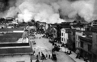
Earthquakes can cause fires by damaging electrical power or gas lines. In the event of water mains rupturing and loss of pressure, it may also become difficult to stop the spread of a fire once it has started. For example, more deaths in the 1906 San Francisco earthquake were caused by fire than by the earthquake itself.
Tsunamis are long-wavelength, long-period sea waves produced by the sudden or abrupt movement of large volumes of water. In the open ocean the distance between wave crests can surpass 100 kilometers (62 miles), and the wave periods can vary from five minutes to one hour. Such tsunamis travel 600-800 kilometers per hour (373-497 miles per hour), depending on water depth. Large waves produced by an earthquake or a submarine landslide can overrun nearby coastal areas in a matter of minutes. Tsunamis can also travel thousands of kilometers across open ocean and wreak destruction on far shores hours after the earthquake that generates them.
A flood is an overflow of any amount of water that reaches land. Flood occur usually when the volume of water within a body of water, such as river or lake, exceeds the total capacity of the formation of the body. However, floods may be secondary effects of earthquakes, if dams are damaged. Earthquakes may cause landslips to dam rivers, which then collapse and cause flood.
Earthquakes may lead to disease, lack of basic necessities, loss of life, higher insurance premiums, general property damage, road and bridge damage, and collapse or destabilization (potentially leading to future collapse) of buildings.
Earthquakes can also precede volcanic eruptions. The largest earthquake that has been measured was the 9.5 magnitude one in Chile in 1960.
I hope you have enjoyed reading these kind of interesting topics.
God bless and keep you safe!!
STARRY DAWN.

"Anatomy of an Earthquake." (Part 2)


"Anatomy of an Earthquake." (Part 2)
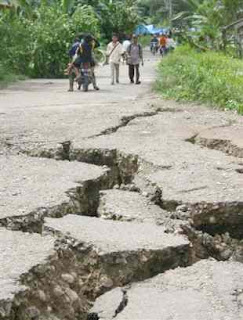
All tectonic plates have internal stress fields caused by their interactions with neighbouring plates and sedimentary loading or unloading (e.g. deglaciation). These stresses may be sufficient to cause failure along existing fault planes, giving rise to intraplate earthquakes.
Earthquakes often occur in volcanic regions and are caused there, both by tectonic faults and the movement of magma in volcanoes. Such eartquakes can serve as an early warning of volcanic eruptions, like during the Mount St. Helens eruption of 1980. Earthquake swarms can serve as markers for the location of the flowing magma throughout the volcanoes.
Most earthquakes form part of a sequence, related to each other in terms of location and time. Most earthquake clusters consist of small tremors which cause little to no damage, but there is a theory that earthquakes can recur in a regular pattern. There are around 500,000 earthquakes each year. 100,000 of these can actually be felt. Minor earthquakes occur nearly constantly around the world in places like California and Alaska in the U.S., as well as in Guatemala, Chile, Peru, Indonesia, Iran, Pakistan, the Azores in Portugal, Turkey, New Zealand, Greece, Italy and Japan, but earthquakes can occur almost anywhere, including New York City, London and Australia. Larger earthquakes occur less frequently.
While most earthquakes are caused by movement of the Earth´s tectonic plates, human activity can also produce earthquakes. Four main activities contribute to this phenomenon: construction large dams and buildings, drilling and injecting liquid into wells, and by coal mining and oil drilling. Most earthquakes form part of a sequence, related to each other in terms of location and time.
Shaking and ground rupture are the main effects created by earthquakes, principally resulting in more or less severe damage to buildings and other rigid structures. The severity of the local effects depends on the complex combination of the earthquake magnitude, the distance from the epicenter, and the local geological and geomorphological conditions, which may amplify or reduce wave propagation. The ground-shaking is measured by ground acceleration.
Ground rupture is a visible breaking and displacement of the Earth´s surface along the trace of the fault, which may be of the order of several metres in the case of major earthquakes. Ground rupture is a major risk for large engineering structures such as dams, bridges and nuclear power stations and requires careful mapping of existing faults to identify any likely to break the ground surface within the life of the structure.
Earthquakes, along with severe storms, volcanic activity, coastal wave attack, and wildfires, can produce slope instability leading to landslides, a major geological hazard. Landslide danger may persist while emergency personnel are attempting rescue.
Part 3 will follow...
Thanks for reading!!
Starry Dawn.

"Pictures of Natural Disasters."


"Pictures of Natural Disasters."

Volcanoes, Tsunami, Flood, etc.

We live in a dangerous world...

Monday, May 17, 2010

"Anatomy of an Earthquake." (Part 1)


"Anatomy of an Earthquake." (Part 1)
Recent severe earthquakes have occurred in the world like the ones in Haiti and Chile in 2010.
Contemporary depictions of earthquakes in films are variable in the manner in which they reflect human psychological reactions to the actual trauma that can be caused to directly afflicted families and their loved ones. Disaster mental health response research emphasizes the need to be aware of the different roles of loss of family and key community members, loss of home and familiar surroundings, loss of essential supplies and services to maintain survival. Particularly for children, the clear availability of care giving adults who are able to protect, nourish, and clothe them in the aftermath of the earthquake, and to help them make sense of what has befallen them has been shown to be even more important to their emotional and physical health than the simple giving of provisions. As was observed after other disasters involving destruction and loss of life and their media depictions, such as those of the 2001 World Trade Center Attacks or Hurricane Katrina, and has been recently observed in the 2010 Haiti and Chile Earthquakes.
An earthquake, a quake, tremor, temblor or seismic activity is the result of a sudden release of energy in the Eath´s crust that creates seismic waves. Earthquakes are measured with a seismometer; a device which also records is known as a seismograph. The moment magnitude (or the related and mostly obsolete Richter magnitude) of an earthquake is conventionally reported, with a magnitude 3 or lower earthquakes being mostly imperceptible, and magnitude 7 causing serious damage over large areas.
At the Earth´s surface, earthquakes manifest themselves by shaking and sometimes displacing the ground. When a large earthquake epicenter is located offshore, the seabed sometimes suffers sufficient displacement to cause a tsunami. The shaking in earthquakes can also trigger landslides and occasionally volcanic activity.
In its most generic sense, the word earthquake is used to describe any seismic even, whether a natural phenomenon or an event caused by humans that generates seismic waves. Earthquakes are caused mostly by rupture of geological faults, but also by volcanic activity, landslides, mine blasts, and nuclear experiments. An earthquake´s point of initial rupture is called its focus or hypocenter. The term epicenter refers to the point at ground level directly above the hypocenter.
Where plate boundaries occur within continental lithosphere, deformation is spread out over a much larger area than the plate boundary itself. In the case of the San Andreas fault continental transform, many earthquakes occur away from the plate boundary and are related to strains developed within the broader zone of deformation caused by major irregularities in the fault trace (e.g. the "Big bend" region).
Part 2 will follow...
Thanks for reading!!
Starry Dawn.

Sunday, April 11, 2010

"The Ozone Layer."


"THE OZONE LAYER."
The ozone layer is a layer of gas in the upper atmosphere which protects humans and other living things from the harmful ultraviolet (UV-B) rays of the sun. In the 1970´s scientists discovered that certain man-made chemicals could destroy ozone and deplete the ozone layer. Further research found that the growing production and use of chemicals like chlorofluorocarbons (CFCs) in aerosol sprays, refrigeration, insulation and air conditioning was contributing to the accumulation of ozone-depleting substances (ODS) in the atmosphere. They also observed that an "ozone hole" was developing above the ANTARCTIC.
A thinning ozone layer leads to a number of serious health risks for humans. It causes greater incidences of skin cancer and eye cataracts, with children being particularly vulnerable. There are also serious impacts for biodiversity. Increased UV-B rays reduce levels of plankton in the oceans and subsequently diminish fish stocks. It can also have adverse effects on plant growth, thus reducing agricultural productivity. A direct negative economic impact is the reduced lifespan of certain materials like plastic.
Severe depletion of the Antarctic ozone layer was first observed in the early 1980´s. The international response embodied in the Montreal Protocol. Today 196 parties worldwide have signed the Montreal Protocol which is widely regarded as the most successful Multinational Environmental Agreement, and it is the first treaty achieving universal ratification. Furthermore, the phasing out of ozone depleting substances (ODS) has helped to fight climate change since many ODS are also powerful greenhouse gases.
Ozone is a gas that occurs naturally in our atmosphere. Most of it is concentrated in the ozone layer, a region located in the stratosphere several miles above the surface of the Earth. Although ozone represents only a small fraction of the gas present in the atmosphere, it plays a vital role by shielding humans and other life from harmful ultraviolet light from the Sun. Human activities in the last several decades have produced chemicals, such as chlorofluorocarbons (CFCs), which have been released into atmosphere and have contributed to the depletion of this important protective layer. When scientists realized the destructive effect these chemicals could have on the ozone layer, international agreements were put in place to limit such emissions. As a result, it is expected that the ozone layer will recover in the coming decades.
Ozone is also a greenhouse gas in the upper atmosphere and, therefore, plays a role in Earth´s climate. The increases in primary greenhouse gases, such as carbon dioxide, may effect how the ozone layer recovers in coming years. Understanding precisely how ozone abundances will change in a future with diminished chlorofluorocarbon emissions and increased emissions of greenhouse gases remains an important challenge for atmospheric scientists in NOAA and other research centers.
OZONE DEPLETION. ANTARCTICA.
Ozone depletion occurs in many places in the Earth´s ozone layer, most severely in the polar regions. NOAA scientists have traveled to Antarctica to study the ozone hole that has been occurring there since the late 1970s. In 1986, soon after the reported discovery of the ozone hole, Aeronomy Lab (now ESRL) scientist Dr. Susan Solomon led a team of 16 scientists, the National Ozone Expedition
(NOZE I) to Antarctica. The scientists took measurements of various trace gases and physical properties of the atmosphere. The data, along with additional findings from the NOZE II mission the following year, showed conclusively that human-produced trace gases that contain chlorine and bromine were causing the ozone hole. The Global Monitoring Division of ESRL has monitored the yearly Antarctic ozone hole since 1986 by using instruments located on the ground and by launching balloon-borne ozonesondes, onboard aircraft and satellites, from the South Pole station and measuring total column ozone from a ground based Dobson spectrophotometer since 1963. This unique record from the South Pole station clearly shows the annual development of the springtime Antarctic ozone hole over the past two decades.
THANK YOU FOR READING!!
STARRY DAWN. If you wish to visit all my BLOGS, I´ll include the LINKS:

Monday, March 22, 2010

"Global Warming."


"Global Warming."
What is Global Warming?... We call the result global warming, but it is causing a set of changes to the Earth´s climate, or long-term weather patterns, that varies from place to place. As the Earth spins each day, the new heat swirls with it, picking up moisture over the oceans, rising here, settling there. It´s changing the rhythms of climate that all living things have come to rely upon. What will we do to slow this global warming?... How will we cope with the changes we´ve already set into motion? While we struggle to figure it out, the face of the Earth as we know it -coasts, forests, farms and snow-capped mountains- hangs in the balance.
The "greenhouse effect" is the warming that happens when certain gases in Earth´s atmosphere trap heat. These gases let in light but keep heat from escaping, like the glass walls of a greenhouse. First, sunlight shines onto the Earth´s surface, where it is absorbed and then radiates back into the atmosphere as heat. In the atmosphere, "greenhouse" gases trap some of this heat, and the rest escapes into space. The more greenhouse gases are in the atmosphere, the more heat gets trapped.
Scientists have known about the greenhouse effect since 1824, when Joseph Fourier calculated that the Earth would be much colder if it had no atmosphere. This greenhouse effect is what keeps the Earth´s climate livable. Without it, the Earth´s surface would be an average of about 60 degrees Farenheit cooler. In 1895, the Swedish chemist Svante Arrhenius discovered that humans could enhance the greenhouse effect by making carbon dioxide, a greenhouse gas. He kicked off 100 years of climate research that has given us a sophisticated understanding of GLOBAL WARMING.
Levels of greenhouse gases (GHGs) have gone up and down over the Earth´s history, but they have been fairly constant for the past few thousand years. Global average temperatures have stayed fairly constant over that time as well, until recently. Through the burning of fossil fuels and other GHG emissions, humans are enhancing the greenhouse effect and warming Earth.
Scientists often use the term "climate change" instead of global warming. This is because as the Earth´s average temperature climbs, winds and ocean currents move heat around the globe in ways that can cool some areas, warm others, and change the amount of rain and snow falling. As a result, the climate changes differently in different areas.
Warming is expected to change the distribution and type of clouds. Seen from below, clouds emit infrared radiation back to the surface, and so exert a warming effect; seen from above, clouds reflect sunlight and emit infrared radiation to space, and so exert a cooling effect. Whether the net effect is warming or cooling depends on details such the type and altitude of the cloud. These details were poorly observed before the advent of satellite data and are difficult to represent in climate models.
The atmosphere´s temperature decreases with height in the troposphere. Since emission of infrared radiation varies with temperature, longwave radiation escaping to space from the relatively cold upper atmosphere is less than that emitted toward the ground from the lower atmosphere. Thus, the strength of the greenhouse effect depends on the atmosphere´s rate of temperature decrease with height.
When ice melts, land or open water takes its place. Both land and open water are on average less reflective than ice and thus absorb more solar radiation. This causes more warming, which in turn causes more melting, and this cycle continues. Warming is also the triggering variable for the release of methane in the Arctic. Methane released from thawing permafrost such as the frozen peat bogs in Siberia, and from methane clathrate on the sea floor, creates a positive feedback.
Ocen ecosystems´ability to sequester carbon is expected to decline as the oceans warm. This is because warming reduces the nutrient levels of the mesopelagic zone.
Release of gases of biological origin may be affected by global warming, but research into such effects is at an early stage.
Aren´t temperature changes natural?...
The average global temperature and concentrations of carbon dioxide (one of the major greenhouse gases) have fluctuated on a cycle of hundreds of thousands of years as the Earth´s position relative to the sun has varied. As a result, ice ages have come and gone.
However, for thousands of years now, emissions of GHGs to the atmosphere have been balanced out by GHGs that are naturally absorbed. As a result, GHG concentrations and temperature have been fairly stable. This stability has allowed human civilization to develop within a consistent climate.
Occasionally, other factors briefly influence global temperatures. Volcanic eruptions, for example, emit particles that temporarily cool the Earth´s surface. But these have no lasting effect beyond a few years. Other cycles, such as El Niño, also work on fairly short and predictable cycles.
Now, humans have increased the amount of carbon dioxide in the atmosphere by more than a third since the industrial revolution. Changes this large have historically taken thousands of years, but are now happening over the course of decades.
THANK YOU FOR READING!!
STARRY DAWN.

If you want, you may visit all MY BLOGS at the following LINKS:


"THE NEW GUINEA SINGING DOG."


"THE NEW GUINEA SINGING DOG."

WELCOME TO ANIMAL´S ADVOCATES WORLDWIDE!!

The New Guinea Singing Dog is a beautiful and intelligent primitive dog in a way to extinction.

I would love to help them!! Perhaps, the animal´s advocates worldwide could do something good to save them from extinction. Unfortunately, extinction is forever.

The New Guinea Singing Dog (Canis lupus hallstromi), known as NGSD, New Guinea Highland Dog, or Singer, is a type of wild dog that is native to New Guinea. Singers are classified as subspecies of Canis lupus and related to Australian Dingo. Singers have remained isolated from other dogs for almost 6,000 years, making them possibly the oldest of the pariah dogs. Today the dwindling wild populations still exist in the Highlands, all that remain of the breed which is thought to have once inhabited the whole of the Island of New Guinea. No confirmed sightings had been reported for years until recently. At least one animal was reportedly sighted by local guides at Lake Tawa. In 1995, the entire captive population was estimated at approximately 300, but today there are may be as few as 100 to 200 or even less numbers. They are exceptionally intelligent, but hard to keep because of wild behavioural traits. However, with proper training and socialization, they will live with humans in a "home" environment. Singers are recognized by Zoo´s worldwide of dogs with great health, for their lifespan is between 15 to 20 years long with no health issues. They are also recognized as a breed by the United Kennel Club, which places them in the Sighthound & Pariah Group. New Guinea Singing Dogs are unique in their ability to howl in a wolf-like manner, but unlike wolves, Singers can modulate the pitch, hence their name. Singers may sing many different songs all together in harmony.

It´s amazing!!... Thank you for reading my blogs!! If you wish to visit all MY BLOGS, I´ll include the LINKS where you may just CLICK:

www.thanksforthegiftoflife.blogspot.com

www.findthewayinyourlife.blogspot.com

www.theexistenceofournaturalenvironment.blogspot.com

www.sissyladoncelladelalba.blogspot.com

www.larosaenelvientodeltiempo.blogspot.com

WELCOME TO ANIMAL´S ADVOCATES WORLDWIDE!!

WELCOME TO MY WORLD!!

STARRY DAWN.